Try the new IKO website at https://beta.ikointl.com/
How Kitesurfers Predict the Weather with Clouds
Author: Bradley Mackelden
How do kitesurfers predict the weather with clouds?
Firstly let's cover why you'd want to predict the weather solely by looking at the clouds around you? This is as close as you'll ever get to a superhero power!
Kitesurfing is a wind dependent sport and one thing which can have a huge impact on the wind around us are clouds. Clouds can do all sorts of funny things to the wind... they can make the wind stronger, weaker, change the direction, or completely kill it off and finish your kitesurfing session prematurely. Therefore as kitesurfers, we need to understand what certain clouds mean and how we should react to them. This knowledge will aid you in choosing the correct size kite, deciding if it's safe to even venture onto the water, or perhaps sneak an unexpected session in which wasn't forecast.
How are clouds formed?
It starts when heat from the sun warms the surface of the earth. Warm air is less dense than cold air thus causing the hot air at ground level to rise. As the hot air rises, water vapour within these air particles starts to cool. For a cloud to form, the water vapour needs something to condense onto. Tiny particles in the air such as dust, salt, smoke provide the perfect surface. When enough vapour condenses around one of these particles a single cloud droplet is formed. The droplets are so small that a cubic meter of air contains 100 million of them. Droplets can combine and once heavy enough will fall from the sky as rain, sleet or snow.
What are low and high pressure systems?
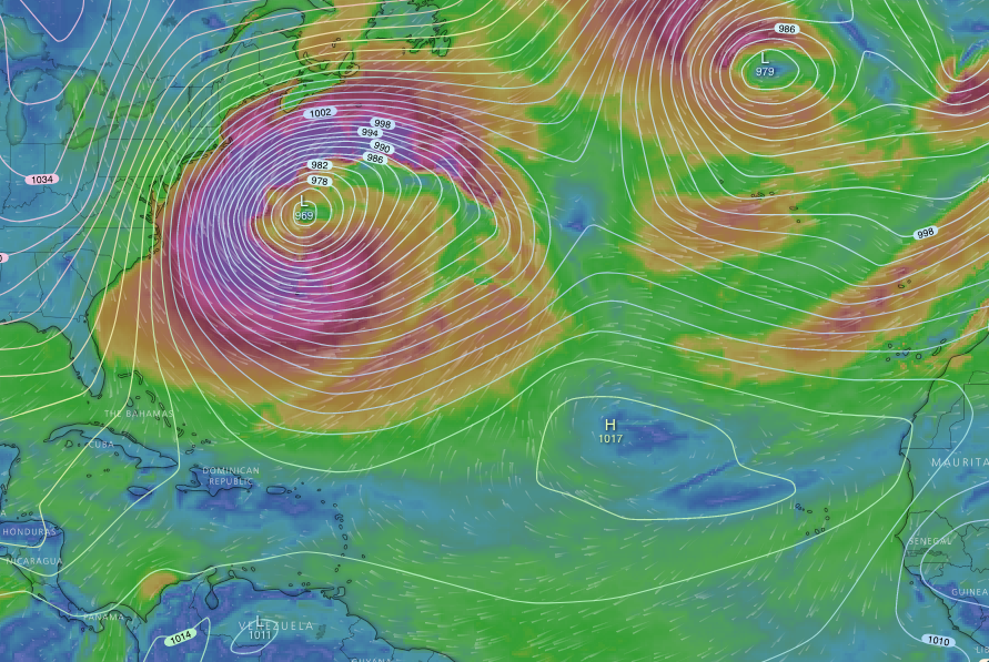
All winds originate from heat generated by the sun. Hot air rises from warmer regions of the earth and then cools as it reaches colder climates. Extremes of this happen at the Equator and the North/South poles.
Standard atmospheric pressure at sea level is 1013, 25 millibars. Anything above this figure is classed as “High pressure” and anything below is classed as “Low pressure”.
Low pressure: An area of low pressure is formed when hot air rises away from sea level into the upper atmosphere thus leaving an area of less dense air near the surface.
High pressure: An area of high pressure is formed when air descends from the cool upper atmosphere towards sea level thus creating an area of dense heavy air near the surface. Hence the name “High Pressure”
Air naturally wants to travel from areas of high pressure towards areas of low pressure. Think of it like an inflated balloon, the pressure inside the balloon is ‘high’ as there are lots of air particles squashed into a small space. When we release the balloon, air flows from the balloon into the surrounding air which is of ‘lower’ pressure. The same is true with the air around our planet. It is the movement of air from one type of pressure system to the other which generates the winds around our planet.
Low pressure tends to bring strong wind and rain, while high pressure tends to bring calm, clear and sunny conditions. I know what I’d choose, even if it does mean a little drizzle! :)
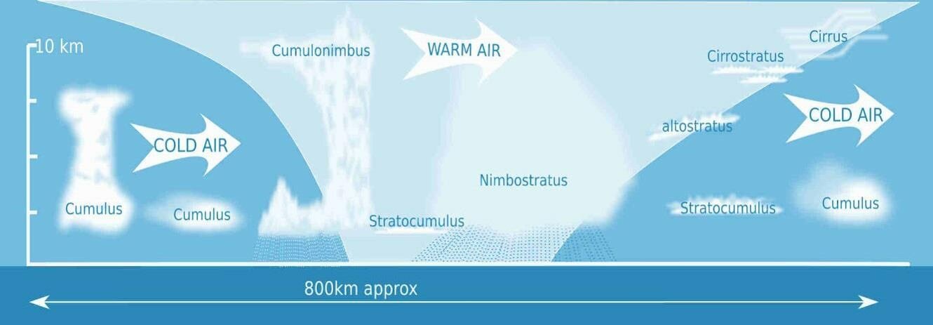
Different types of clouds, what they look like, what weather to expect!
Fairweather Cumulus: These are low-level clouds which look like fluffy pillows of rolling mounds appearing during warm sunny days.
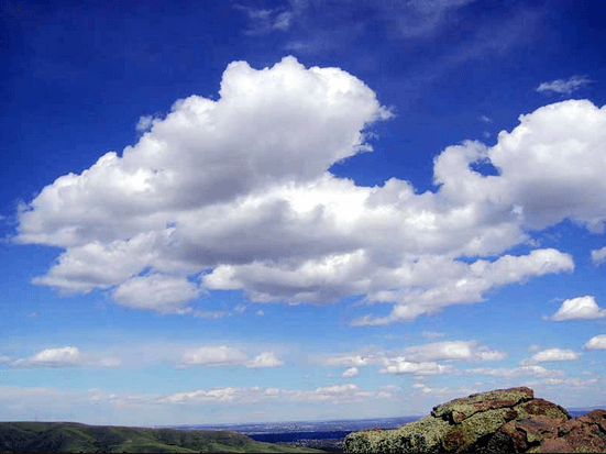
What to expect: When they appear in a high-pressure, this is a sign of a potential sea breeze. Ideal for sneaking in that unexpected session, time to call your mates and hit the beach for a kitesurfing session! For anyone that's not familiar with the term ‘sea breeze', this is a microclimate effect that can increase the wind speed providing the originating wind is blowing in an onshore direction.
Cumulonimbus: These start as cumulus clouds but continue to grow larger and larger. In extreme cases, they can develop into a shape not dissimilar from a huge peeling wave. Cumulonimbus clouds start at a low level but can grow until 10-12km in height.
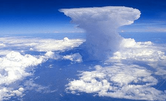
What to expect: You can expect heavy rain and strong squally winds. These clouds can move in any direction, even against the wind. Therefore making them the most concerning to kitesurfers. Read on to see my top tips if you spot a Cumulonimbus cloud while kitesurfing.
Altocumulus: Layered rippled elements. They look like several cumulus clouds attached together.
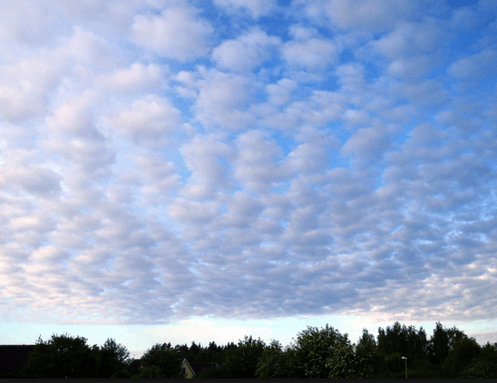
What to expect: These clouds are also known as pre-storm clouds. They are often followed by thunderstorms and turbulent weather
Nimbostratus: These are the largest cloud type, often very thick and can completely block the sun from penetrating through to ground level.
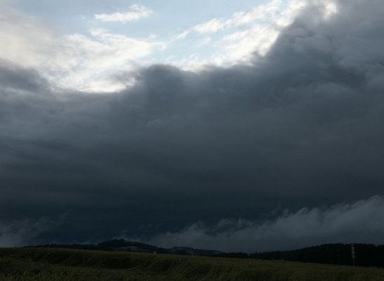
What to expect: Get your rain jackets out because you can expect heavy rainfall or snow for days to come!
Cirrus: High-level clouds which are very thin and wispy. Due to being formed at high altitudes, the water droplets will have crystalised into ice. Looks similar to my hair on a 40knot day down the beach.
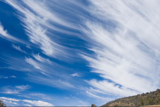
What to expect: An early sign of a low-pressure system approaching. Get your 7m ready it's time to send it! yeeew!!!
Cirrostratus: Another high-level cloud appearing in layers often making the sky appear whiter in colour.
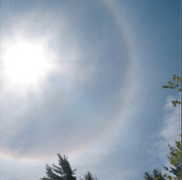
What to expect: These clouds are a good indicator of low-pressure systems coming your way.
Top Tips
Ask your instructor for advice
When taking your first kitesurfing lessons, ask your instructor to point out different cloud types during the lessons. The best way of being able to differentiate between them is to see first hand. Every cloud is different and they will not always look the same, but it’s a great place to start.
Keep checking your surroundings especially upwind!
When kitesurfing it is important to have an eye on your surroundings. More often than not, most squalls and bad weather coming your way will be approaching from upwind. Therefore keep looking over your shoulder now and again to ensure it's safe to keep kitesurfing. However this is not always the case as explained above, a Cumulonimbus clouds can approach from any direction even against the wind. If you see a cumulonimbus cloud approaching mid session your safest bet is to head back to the beach, land your kite and wait for it to pass.
If ever in doubt, get out!
This is important, if you are ever unsure of what the weather is going to do. Again the main one here is the Cumulonimbus cloud. If you arrive at the kite beach and spot one of these approaching, wait until the wind has settled before venturing into the water. Trust me, you don't want to chance having a kite up in strong squally winds, it can be extremely dangerous.
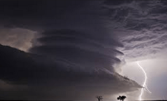
Don't let a strike turn off your light!
If you ever hear or see thunder and lightning approach, return to the beach and safely land your kite away from the water's edge.
Develop your knowledge of this subject and many more
The IKO recently revamped the Assistant Training Course (ATC) by dividing the course into two modules - Module 1 eLearning and Module 2 In-Person Training. Module 1 covers concepts and theory, this can be taken online from anywhere in the world. Module 2 is hands-on training which must be completed at an IKO Center.
The ATC is not just for people who want to become IKO Assistants or teach kitesurfing, it’s also for kiters who simply want to increase their knowledge.
For more on predicting the weather with clouds and other key kite concepts, check out the new IKO Assistant Training Course, which you can now start online from the comfort of your home.
.png)

